
Drone Services
Foster CM Group can supply drone photography and video solutions for to A/E/C and real estate markets. Whether you need to record construction progress or secure images for marketing, our licensed drone pilot can serve your needs.
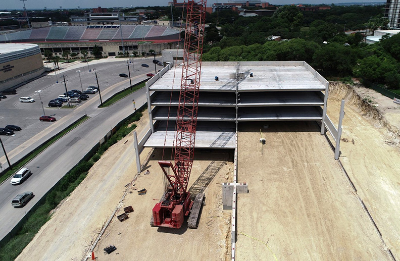
Capitalizing on the progress of your construction projects via drone services offers a dynamic and extensive visual. Drone solutions can serve as time-lapsed progression or documentation of site conditions for analysis and quicker decision making.
Additionally, drone photography can achieve dramatic photos and video footage of your finished project for any of your marketing and media needs.
Our pilot is Part 107 licensed and fully insured. We are committed to delivering the best aerial imaging to assist in managing resources efficiently and help clients save time and money.

Track and Capture Work
Site Progress
- Track site progress using 4k video, photos and panoramas of your work in progress
- Capture job site data
- Share a visual timeline with all stakeholders
- Detect plan defects and deviations for correction by comparing actual conditions to pre-construction designs
- Analyze and mitigate risks
- Inspect your entire job site safely

High Resolution 2D/3D Orthomosaic Maps
With high resolution 2D/3D orthomosaic maps or models your client can:
- View Elevation Data
- Monitor Plant Health
- Track Changes Over a Period of Time
- Generate Contour Lines

Normalized Difference Vegetation Index (NDVI)
- Analyze remote sensing measurements
- Assess whether or not the target being observed contains live green vegetation
- Estimate crop yields, and performance,
- Estimate percentage of ground cover, photosynthetic activity of the plants, surface water, leaf area index and the amount of biomass